Monday we moved our boat over to Key Biscayne, which we guess is the first of the Florida Keys!
It set us up for an easy entrance to the Atlantic Ocean. We took some good advice and did a test run through the channel out to the ocean in the day light so that we could plot a line to follow on our Garmin.

This lil island reminded us of the Memorial in DC

We wanted to leave by 3am but overslept and were on our way by 4am. We couldn't fall asleep due to our excitement! We followed our previously plotted line and easily made it out to the ocean in the dark.

Around 6am light started to show and the sun rose around 6:30 am.

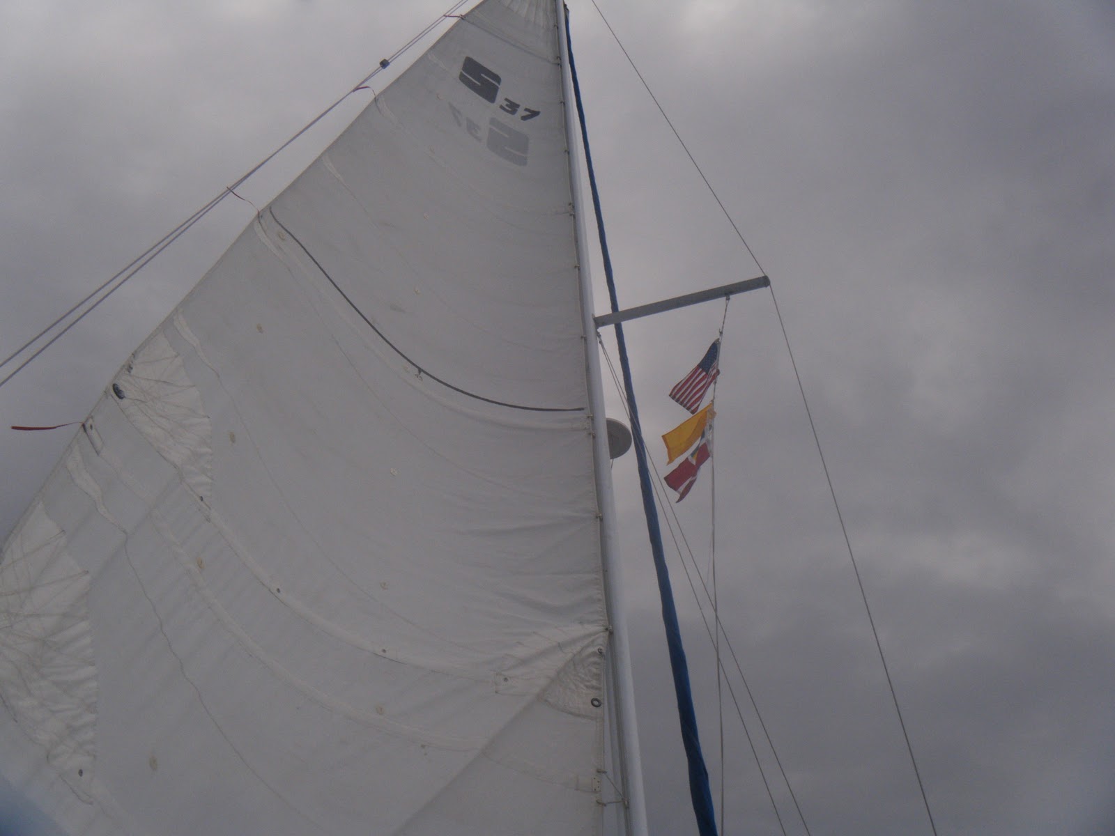
The wind was about 9 knots so we were able to motor sail through a light chop.


Hello World

A lil taste of our trip
The water was a gorgeous deep blue! The picture doesn't do it justice.

Around 9am we lost sight of Miami and all we could see was blue 360 degrees

We see the Bahamas!!!

We hoisted our Q flag and courtesy Bahama flag
Around 11am we noticed a squall on our tail.

We got to the channel around 12:30 but the squall finally caught us so we turned around and circled till the rain passed us, it last about 5 minutes.

And then we could see the bright water!

Nala was mad she wasn't allowed on deck during the crossing

During the crossing we were in depths up to 2800 feet! Our depth sounder couldn't handle that and started blinking around 600 feet. It didn't come on right away when we got to the channel and we were a lil concerned. It came back on though right at we got to 20 foot depths. It didn't help though as we quickly ran aground!
The Explorer Chart, the Garmin, and the actual depths all disagreed and our visual depth readings weren't up to par yet. We were stuck on the shoal pretty good and cringed each time the water slammed our keel down on the sand. We called Tow Boat and they answered quickly and were about to send someone when somehow we were lifted/pushed off the shoal and were floating again. We looked at each other surprisingly and motored away from the shoal. We then called the local water taxi to let us follow them in.

By 1:40pm we were tied up to Weechs Bimini Dock, safe and sound. We decided to stay at a marina the first night since it was right next door to customs. Customs was a breeze and within an hour we were legit!
The water is so pretty here, in some places its as clear as a fish bowl!


We finally made it :)
5 comments:
Love the picture of your first glimpse of the Bahamas! Ya'll made it with no major problems all the way from the upper East coast during winter... what an accomplishment! Now it's time to celebrate!
Thanks for answering the first things that popped into my head; and that's whether you'd run aground yet or if your cats were still on board! I freak out when anything out of ordinary happens so I really envy you your attitude. So now when things get dicey I say to myself, "Well that wouldn't have bothered Joey and Christine!"
Congrats on your first blue water trip.
The 1000 islands on the Saint Lawrence river in New York is very clear water. You get a sense pretty quickly about water depth by just visual observation.
I guess I would ask who makes the charts for the Bahamas. I have garmins charts but NOAA may not have made the original chart they were based on. Not to be too ethnocentric but do those Bahamans update their charts? (Do we??!!)
Turning off the depth finder and turning it back on when you thought the depths had come back to something it could read might have rebooted it.- just guessing
Jay
MLC - We hope the next year will be one big celebration!
Knotty Cat - yea we weren't trusting those silly cats to roam around on their own. Nomy paid us back by throwing up in our bed.
Jay - From what ive heard, the Bahamas dont change the markers very often to show the shoals, they just rely on their visual depth reading. So i guess we need to get better at that. When we followed the local in we went through areas marked as 3 foot shoals in the chart.
As for the depth sounder, we did reboot it but it still did not work right away. that wasnt the reason we grounded anyway though.
Congrats!
Excellent crossing pictures and conditions, It’s important to know when to jump and when to stay put. Seems you jumped just right as the door has slammed shut for the next week or so. Now slow down and smell the flowers (ah I mean the coral). You guys have earned your time in the islands mon. Few cruisers could have left as late in the season and endured the cold and adventures that you’ve had and still been smiling.
Gordon, Bonnie & Simbad the Sailing Cat
Note to Nala: I hate when they close me in the cabin for my own safety. Ya right like I would jump ship half way there, Don’t think so.
Simbad
Post a Comment