


We ran into some trouble at the first bridge we had to request to open. Our handheld VHF was dead, we must have left it on all night. So we frantically searched our boat for the charger, but since we have crammed so much stuff on board we couldn’t find it. And it may or may not have been accidently thrown away. So we brushed off the dust on our original boat VHF but the buttons 3, 6, and 9 wouldn’t work. Which sucks cuz 16 is the common channel and 13 is the bridges. Hmmm….
After Christine did a bunch of circles outside the bridge while I banged on and cursed the VHF, we noticed another sailboat pull up to the bridge so we just waited for the bridge to open for them and followed them in. We know, smooth……

So we called up our favorite retailer, West Marine, and had a new charger purchased and shipped to the WM in Oriental, NC. Meanwhile we called up family members to get the phone number of the two bridges we needed to open between here and Oriental. Thanks!

Then things got Dismal. Well we entered the Dismal Swamp! And it was all it was cracked up to be. We didn’t see any alligators, but there were A LOT of logs floating around and I liked to pretend some of them were alligators. Overall it was peaceful and scenic, for a swamp. Christine sat at the bow and directed me away from any debris and kept us in the middle. This canal is nicknamed “The Ditch” because of how often boats run aground so we had to be on our toes. We got to use our Marriage Savers walkie talkies. They worked great and were much better than our flashing lights direction system. We proudly made it through without touching ground!


We went through our first lock! The Deep Creek Lock. The lock master was very entertaining and helpful. He asked us to bring him back a conch shell. At first we didn’t understand why but were like sure, but then we saw that he had a conch garden from previous cruisers that passed by. And then he told us and proved that he the best conch player around. Apparently you can blow in them and play notes like a trumpet. He was really good and played a precise song. We will have to learn how to do that!


More Dismal.


The lock master warned us about the dredging taking place so it made our path even narrower trying to stay away from the dredge lines.

We pulled over and stayed at the Dismal Swamp Welcome Center that night. Our third free dock in a row! And for the third time Nala immediately jumped off. She began running back and forth like a dog. We think shes losing her mind.


We got a lot of free garb at the welcome center including 2 DSC (Dismal Swamp Canal) stickers, a NC cruising guide, Florida cruising guide, and many other maps. We love free stuff!

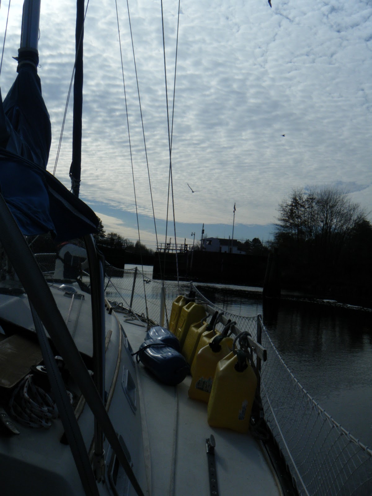
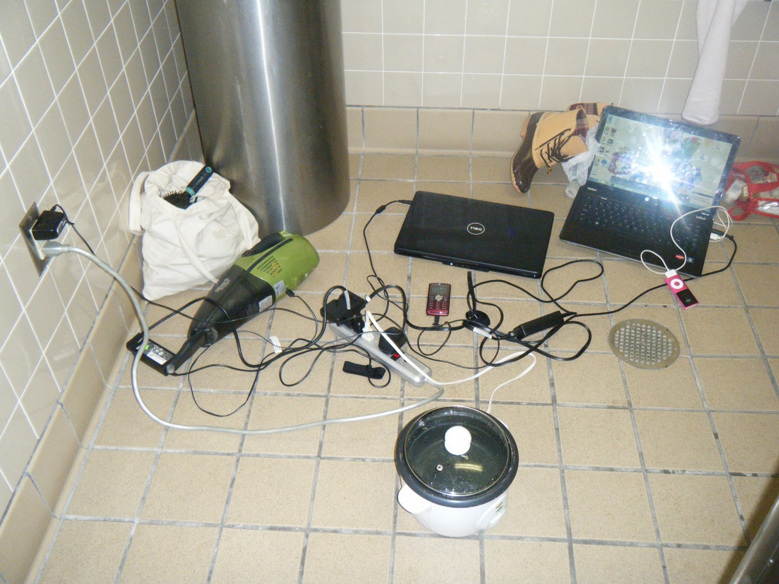
We also love free electricity. Since the days have been gloomy the Solar Panels have been weak at best. The engine alternator replenishes a little more than we use each night. I’ve been keeping an eye on it and we stay between 85 – 95% battery level. We do have a separate starter battery tho that stays charged always. So since we were at a public bathroom with outlets we took advantage and charged ALL of our electronics. We also made hot water with the rice cooker to wash our selves! So we took our first “shower” in 4 days.
We awoke fresh and fully charged ready for another day on the DSC! We had to go through another lock at South Mills and then more Dismal….


Before we made it back to the main ICW we went through a slightly frozen area. We didn’t notice until we could hear the ice breaking and soon we were plowing through all ice. It sounded really cool. Enjoy the video!

We crossed the Albemarle Sound which was just a huge open calm body of water. We saw some kind of fins but couldn’t confirm its identity. We can’t wait to see our first dolphins.

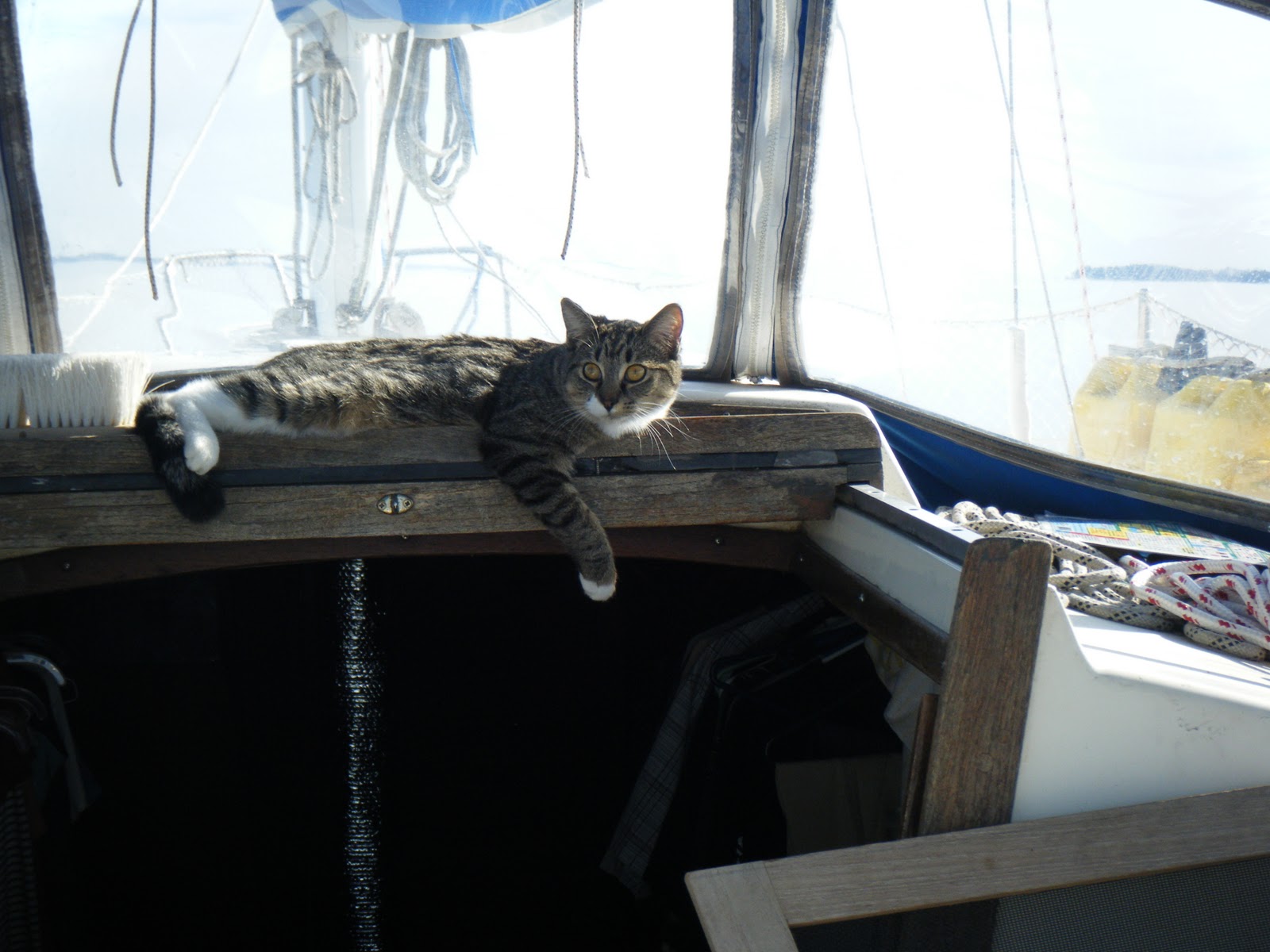
While Nomy still just stays inside, Nala has gotten VERY comfortable on deck.

She even knows where to soak up the most sun.

Just before the Alligator River Swinging Bridge we had to pass through some shoals and I guess one side was sticking out further than the Garmin thought cuz we ran right into it! (N35'56'34.7 W75'59'22.1) The only hard part was figuring out which side shoal we ran into cuz the Garmin showed us in between two. Once we figured it out we were able to spin and throttle off the ground. Back on our way! We went through the Alligator River Swinging Bridge which was pretty cool. They had to stop traffic just to let our little boat go through. We waved

We were full of excitement (and Mountain Dew) and making such good time that we decided that we could keep going through the night and be in Oriental by the morning! But as the sun set and the moon decided to take the night off it got really dark. Too dark even for our spotlight to do much. And then there was the Alligator River Canal coming up which is as skinny as the Dismal Swamp Canal. So we wisely choose not to continue and just anchored at the mouth of the Canal.

We are in Alligator River but have yet to see a single alligator. We really want to see one. We cooked bacon for dinner and hoped it would attract some alligators and I scanned the water with the spotlight but still nothing. We kept the cats inside at all times though….
5 comments:
Great post guys. My journey to FL started on the Pamlico River, so I missed the swamp. Feels like I was there though with all the pics you posted. There is some great sailing ahead as you get closer to Oriental, so enjoy. Looking forward to the next post.
Jim
You were fortunate that your VHF was dead going through the norfolk area bridges. The bridge tenders in that area can be quite rude.
You were lucky going through the Albemarle sound if it was glass smooth. This area along with the mouth of the Potomac River seem to get the worst ratings from cruisers.
Would you post the coordinates at which you went aground at the alligator river? I’ve seen many cruisers post about problems here, yet no one does anything to help the next guy. My garmin charts show a recommended pink route through here, which I took except for the area south of markers 7 and 8 where I took a track closer and even touching the southern most tip of the 5 foot shoal to the east. I assume there were small temporary markers guiding me here but I don’t remember. Maybe they are not there now? (also I draw only 2 feet) My charts are version 2008.5. (and not the G2) Is that what you use?
I see you on the Oriental web cam this morning!
Jay
Great post! Ya'll are really moving along, making it all look like a piece of cake. Guess you'll need to mail all those winter clothes back to family for storage soon!
Jay we ran aground at
N35'56'34.7
W75'59'22.1
I believe the West shoal extends further than the chart shows
I passed by that position at N35 56 34.9 W75 59 22.3. Which is only about 25 feet to the west. Your position certainly does show you to be on the recommended route on my chart. Again, I only draw a couple feet. It's not supposed to be a tidal area so that shouldn't be it. Wind tides can effect the area but it looked like the winds were less at 10 MPH easy.
Can anyone give a position near these two points where they transited without grounding?
Jay
Post a Comment